Get Started on Your Graduate Degree Online Today!

The M.S. degree in Geosciences with a concentration in Environmental Geosciences was designed for students interested in graduate study of a broad cross section of the geosciences. It is a 30-credit hour, non-thesis program offered both on-campus and online.

Program highlights:

  • The 10-course program of study includes courses such as ocean science, climatology, Geographic Information Systems (GIS) and hazards.
  • The degree program is reputable, accredited and flexible.
  • The whole degree can be completed online. At various semesters, the department may offer an in-person Field Methods Seminar, which is a field-based course, or GR 8573 Research in Applied Meteorology, which is an on-campus workshop. Both options are offered during the summer semester. If interested, this in-person option can be discussed with a program advisor.
What are some potential careers?

Many graduates pursue careers as geotechnicians, research assistants, geographical information systems (GIS) analysts, remote sensing specialists, petroleum geoscientists, educators, and more.

Who should pursue this degree?

People who are fascinated by nature and passionate about conservation find this a very interesting degree.

Program Structure

  • Students complete 30 semester hours which consists of 10 courses.
  • To be considered for admission, students should have completed an Earth Science and Weather & Climate course or equivalents.
  • All courses are offered on the semester schedule.
  • All courses are offered online with the exception of the field methods course.
  • Students will choose between two final courses; GR 8410 Field Methods Seminar or GR 8573 Research in Applied Meteorology
  • Students normally take two courses per semester but may elect to take only one per semester.
  • Students must pass the comprehensive written exam after completion of all course work.
  • Course materials such as exercises, assignments, study guides, exams, and lectures will be delivered via the Internet using Canvas. Canvas is a software program designed specifically for online learning.
  • Top-quality instructors teach the classes. All classes have instructors with advanced degrees who are recognized experts and real-life practitioners in their field.

Required Courses

Course Number Course Title Hours
GR 8553 Research Methods in Geoscience 3
Choose one of the following:
GR 8410 * Field Methods Seminar 3
or
GR 8573 * Research in Applied Meteorology
Choose at least three from the following:
GR 6303 Principles of GIS (Geographic Information Systems) 9
GR 6313 Advanced GIS (Geographic Information Systems)
GR 6333 Remote Sensing of the Physical Environment
GR 6343 Advanced Remote Sensing
GR 6643 Physical Climatology
GG 8203 Ocean Science
GG 8233 Environmental Geoscience
GR 8633 Climate Change
GR 8813 Advanced Hazards and Disasters
Geosciences Electives:
(Any of the graduate coursework offered online may fulfill this requirement. At least 15 hours of the degree must be at 8000-level. Please check course prerequisites before registering.)
15
Total Hours: 30

* Available to students only during their final summer semester.

Note: A split-level course completed at the undergraduate level cannot be repeated on the graduate level for use on the program of study.


Core Course Rotation:

FALL SPRING SUMMER
GR 6303
Principle of GIS
GR 6313
Advanced GIS
GR 6303
Prnciples of GIS
GR 6333
Remote Sensing of the Physical Environment
GR 8553
Research Methods in Geoscience
GR 6343
Advanced Remote Sensing
GG 8233
Environmental Geoscience
  GR 6643
Physical Climantology
GR 8553
Research Methods in Geoscience
  GG 8203
Ocean Science
    GR 8410
Field Methods Seminar
    GR 8573
Research in Applied Meteorology
    GR 8633
Climate Change

GR 8813 Advanced Hazards and Disasters has a variable schedule, check with advisor.


Milestones

Year 1

Fall, Spring, Summer
Concentrate on course work. Try to complete required courses as they are offered so your graduation will not be delayed if you are unable to take them later.  Remember that a minimum of 15 hours of coursework must be at the 8000-level. You may take some 6000-level courses but be sure that half of all coursework is at the 8000-level.


Year 2

Fall Semester
In addition to continuing your coursework, we will also conduct an interest survey to determine which summer field courses to offer.  If you plan to take GR 8410 Field Methods Seminar in the summer of Year 2, be sure to watch for, and complete this survey.  Students will do the actual sign up for Field Courses at a later date (typically during the Spring registration period).  Note that field courses may also be offered in the Spring and Fall semesters to accommodate students who may be on different timelines.

Spring Semester
In the Spring term of your second year, you will enroll in GR 8553 Research Methods. (Note: The Fall offering of GR 8553 is for AMP students only). This course will assist you in applying research principles to your field of study. You will need to monitor your email for information regarding comprehensive exams, and field course sign-up. This information will typically be emailed in February. During the Spring registration period, be sure to register for your summer Field Course (GR 8410) as this is a required course and must be completed prior to graduation.

Summer Semester
As you prepare for your end of summer graduation, you will complete the Comprehensive Exam (typically offered in mid to late May).  MSU requires that non-thesis graduate students must be within 6 hours of graduation, or in their final semester to take the Comprehensive Exam.  Students must also have a GPA of 3.0 or higher.  In the summer term, you will also apply for graduation via your myState portal (in June) and complete your GR 8410 Field Methods course as well as any remaining coursework.


Important Notes for Students Taking Only 1 Course per Semester:
For ENGS students, GR 8553 should be taken in your final spring semester. GR 8410 Field Methods Seminar should be taken during your final summer semester (or within your final 6 hours of coursework if you graduate in a semester other than summer).

Admissions Process

Admissions

An applicant for admission to the MS-ENGS program must hold a bachelor's degree from a fully recognized four-year educational institution that has unconditional accreditation with appropriate regional accrediting agencies.

Regular admission to graduate study in the Master of Geosciences program requires a minimum grade point average of 2.75 on the last 60 hours of undergraduate work. A student admitted to the Environmental Geosciences Concentration must also have completed GG 1113 and GR 1133 or their equivalents (a Physical Geology/Survey of Earth Science course and a Weather and Climate course). Specific classes may require further prerequisites, but all prerequisite courses may be taken through distance education.

GRE

The GRE is not required for admission into this program.

We will consider applications for the MS-ENGS at any time.

Follow the guide below to ensure that you complete all that is necessary for taking courses in the Environmental Geosciences (MS-ENGS) program at Mississippi State University.

Mississippi State University
Office of the Graduate School

P.O. Box G
Mississippi State, MS 39762-5507

  • Fill out the online Application for Admission. The application requires a Statement of Purpose and the names and email addresses of 3 individuals submitting letters of recommendation on your behalf. Each reference will be provided with a form to complete.
  • Submit a $60.00 or $80.00 international (non-refundable) application fee, payable online or to MSU Office of the Graduate School, P. O. Box G, Mississippi State, MS 39762-5507.
  • Submit one official transcript from the awarding institution of your undergraduate degree either electronically to gradapps@grad.msstate.edu or by mail to:
  • You will receive an email of acceptance when you are officially admitted to MSU.
  • Register for the Online@State Orientation course which will prepare you for online learning at MSU.
  • Textbooks are available 2 to 3 weeks prior to classes beginning and can be ordered through Barnes & Noble at MSU.
  • You will be able to access Canvas on the first day of the semester. To access your courses, enter your NetID and NetPassword and click the Classroom tab.

Courses

GR 6303 Principles of GIS
(Prerequisite: Junior or graduate standing, or Consent of Instructor) Two hours lecture. Two hours laboratory. Spatial analysis and topological relationships of geographic data using Geographic Information Systems, with emphasis on GIS theory.


GR 6313 Advanced GIS
(Prerequisite: GR 4303/6303 or Consent of Instructor) Two hours lecture. Two hours laboratory. Vector-based file structure and GIS queries using spatial and geo-database attributes. Descriptive and prescriptive modeling in the raster domain including regression and linear weighted modeling.


GR 6333 Remote Sensing of the Physical Environment
(Prerequisite: GR 3303, GR 3311 or Consent of Instructor) Two hours lecture. Two hours laboratory. Examines remote sensing methods applicable to large-area analyses of watershed-level drainage systems, urban landscape, landscape vegetation metrics, physical landscape structural components, and atmospheric features.


GR 6343 Advanced Remote Sensing


GR 6473 Numerical Weather Prediction
(Prerequisite: Consent of Instructor) Three hours lecture. This course provides students with an overview of the theory, processes, developments, and applications of existing numerical weather prediction platforms.


GR 6353 Geodatabase Design
(Prerequisite: GR 4303/6303 or Consent of Instructor) Three hours lecture. Examination of Geodatabase structures. Integration of relational databases with Geographic Information Systems. Management of spatial data using geodatabases. Implementation of Geodatabase processes through spatial programming.


GR 6363 GIS Programming
(Prerequisite: Either GR 4303/6303 or Consent of Instructor) Two hours lecture. Two hours laboratory. Design and implementation of geoprocessing scripts. Incorporation of modeling languages within geographic information systems (GIS) analysis. Seamless integration of other software programs with GIS software.


GR 6643 Physical Climatology
(Prerequisite: GR 1133 or consent of instructor). Three hours lecture. An investigation of the physical aspects of Earth’s climate, including interactions between the atmosphere, hydrosphere, and land surface, and how they are affected by climate variability and change.


GR 6753 Satellite & Radar Meteorology
(Prerequisite: GR 1133) Three hours lecture. Study of the history, the operations, and the applications of satellites and radar in weather analysis. Theory of meteorological measurements in determinations of atmospheric structure.


GR 6823 Dynamic Meteorology I
(Prerequisite: GR 4733/6733) Three hours lecture. In-depth examination of the theoretical methods for determining atmospheric stability and the tools necessary to integrate the vertical profile of the atmosphere.


GR 6843 Severe Storm Methods
(Prerequisite: Consent of Instructor) Two hours lecture. One hour field experience. Application of the latest synoptic and mesoscale severe weather forecasting methods concluding with field operations in the U.S. Great Plains.


GR 6923 Severe Weather
(Prerequisite: GR 4913/6913 or equivalent) Three hours lecture. Descriptive study of severe and unusual weather across the earth. Explanation of variations in severe weather in both spatial and temporal scales.


GR 6933 Dynamic Meteorology II
(Prerequisites: GR 4823/6823 and MA 2733) Three hours lecture. Quantitative analysis and consideration of atmospheric circulation including jets streams, mid-latitude cyclones, vorticity and atmospheric kinetics.


GR 6943 Tropical Meteorology
(Prerequisite: Consent of Instructor) Three hours lecture. Topics include the dynamics and circulation of the tropical atmosphere, characteristics of tropical cyclones, and forecasting methodologies for tropical weather.


GG 8123 Geology II: Earth, Time and Life
(Prerequisite: GG 6103 or consent of Instructor) Three hours video and online. Principles of historical geology with emphasis on geological time, earth history, fossils, evolution, and extinction.


GR 8123 Meteorology II: Forecasting and Storms
(Prerequisite: GR 6113 or consent of Instructor) Three hours lecture, video and online. Continuation of Meteorology I. Emphasis on the forecasting of daily weather events and on severe weather.


GG 8133 Rocks and Minerals
Three hours video and online. Principles of mineralogy with an emphasis on rock formation and classification.


GR 8133 Foundations in Forecasting
(Prerequisite: GR 8123 or Consent of Instructor) Three hours lecture (online). Emphasis on daily weather forecasting at the synoptic and meso scales and introduction and investigation of advanced methods.


GR 8143 Advanced Forecasting Techniques
(Prerequisite: Consent of Instructor) Three hour lecture. Regional and mesoscale forecasting topics and techniques, including coastal meteorology, mountain meteorology, fire weather, aviation meteorology and winter weather.


GG 8203 Ocean Science
(Prerequisite: GG 6103 or Consent of Instructor) Three hours video and online. Comprehensive examination of the ocean world, focusing on the topography, physics, chemistry, and circulation of the oceans.


GG 8233 Environmental Geoscience
(Prerequisite: GG 6103 or Consent of Instructor) Three hours video and online. Study of current environmental problems associated with the earth science realms; atmosphere, biosphere, hydrosphere, and lithosphere.


GG 8313 History of Life
(Prerequisite: Consent of Instructor) Three hours video and online. Paleontological principles with an emphasis on history of life through geological time.


GG 8343 Paleontology of Dinosaurs
Three hours lecture video and online. Application of evolutionary and taxonomic principles to the study of dinosaurs and their paleo-environments. This course is designed as a distance learning course for in-service teachers who are required to teach earth science topics with little or no background knowledge in this subject


GR 8410 Field Methods Seminar
(3-4 hours, credits to be arranged.)(Prerequisite: Consent of Instructor) May be repeated for credit two times. A seminar providing synthesis of multiple Geoscience subtopics held in rotating field experience locations.


GG 8423 Earthquakes and Volcanoes
Three hours video and online. A study of plate tectonic boundary interactions with an emphasis on earthquakes and volcanoes.


GR 8453 Quantitative Analysis in Climatology
(Prerequisite: Consent of Instructor) Three hours lecture. Implementation of quantitative methods in climatology, including modeling, resampling methods and spatial techniques, emphasizing climate analysis software packages and data formats.


GG 8503 Landforms
(Prerequisite: Consent of Instructor) Three hours video and online. Geomorphological principles with an emphasis on landforms of North America and their formation.


GR 8553 Research Methods in Geoscience
(Prerequisite: Consent of Instructor) Three hours seminar and forum. Defining research problems, formulating hypotheses, collecting data, using analytical techniques, substantiating conclusions for geoscience topics; written and oral presentations of research projects required.


GR 8573 Research in Applied Meteorology
(Prerequisite: Consent of Instructor) Capstone Course. Seminar. Discussion and application of current research in applied meteorology. Individual or small group projects with research presentations.


GR 8613 Hydrometeorology
(Prerequisite: Consent of Instructor) Three hours lecture-video and online. Hydro meteorological principles with an emphasis on flood forecasting.


GG 8613. Hydrology
(Prerequisite: GG 6103 or Consent of Instructor) Three hours lecture, video and online. Investigation of the occurrence, distribution, movement, and chemistry of earth's waters. Emphasis on geological controls of surface and groundwater.


GR 8633 Climate Change
(Prerequisite: Consent of Instructor) Three hours lecture. In-depth examination of changes in earth’s climate through time. Focus is placed on causes, measurement, implications and complexity of climate change.


GG 8733 Geology of North America
(Prerequisite: Consent of Instructor) Three hours video and online. Plate tectonic evolution of the North American continent with emphasis on both process and stratigraphic development.


GR 8813 Advanced Hazards and Disasters
(Prerequisite: Consent of Instructor) Three hours lecture. Advanced study of the processes, distribution and impacts of hazards and disasters. This course has a variable schedule, check with advisor.


GR 8833 Weather and Society
(Prerequisite: Consent of Instructor) Three hours lecture. Study of the role of weather in and on society through readings, discussion and research.

See More

Academic Advising

Yasma Jacobs Headshot

Yasma Jacobs

Geosciences

  • Academic Advisor

Students should contact Yasma Jacobs, Academic Advisor, about advising or if you have not been released to register by the time registration begins.

All returning students will be sent an email to their MsState email account during the advising periods with course schedule recommendations and a release to register.

Geospatial Technologies Minor

The Department of Geosciences at Mississippi State University offers a minor in geospatial and remote sensing technologies. The minor can be fulfilled by completion of 12 credit hours in GIS courses.

GIS minor highlights

  • All classes have instructors with advanced degrees who are recognized experts and real-life practitioners in their field.
  • The minor can be completed along with your master’s degree.

Requirements

Select four courses from the courses below to obtain the GIS minor:

Fall Courses

  • GR 6303 Principles of GIS (offered summer and fall)
  • GR 6333 Remote Sensing Phys Env (offered fall)
  • GR 6363 GIS Programming (offered fall)

Spring Courses

  • GR 6353 Geodatabase Design (offered spring)
  • GR 6313 Advanced GIS (offered spring)

Summer Courses

  • GR 6343 Advanced Remote Sensing

What are some potential career advantages?

Consider this minor if you would like to enhance your skills in other professions that may require or sometimes use GIS such as geology, meteorology, forestry, emergency management, environmental science, city planning and organization, utilities management and more.

Who should pursue this minor?

This minor can serve the needs of graduate students with diverse backgrounds from a variety of disciplines.

GIS Minor Request

Any current graduate student interested in earning a Geospatial Technologies (GIS) minor through MSU Geosciences Online Education Department can submit an official request by completing and submitting a GIS Minor Request Form.

By completing the request form, you are officially requesting to declare a minor in GIS along with your graduate degree from MSU.

*A committee request form will be required during your final 1-2 semesters in the graduate program

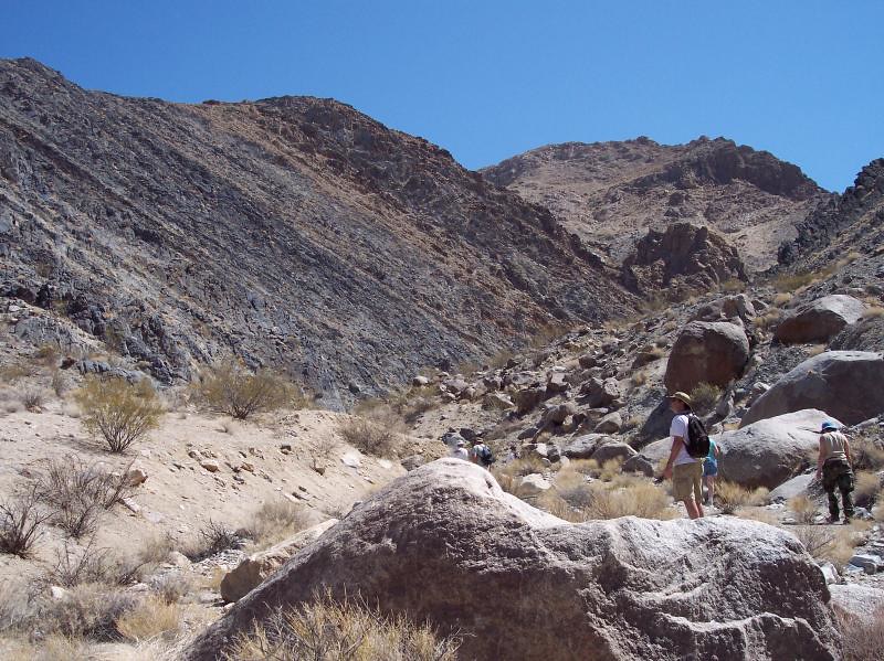
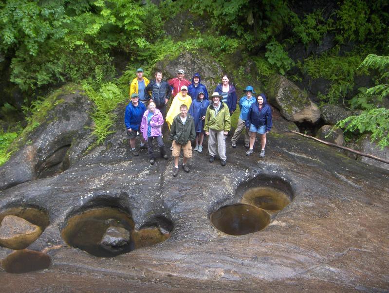
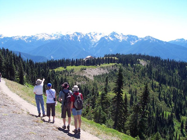
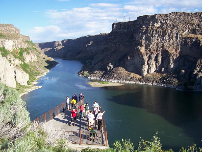
Field Methods

The Field Methods course is a course option available to MS-ENGS students. Near the end of the program, students may choose one of the pre-determined destinations around the country for the GR Field Methods course. The student will travel to the location with approximately 10-12 other students and MSU professors to participate in planned, hands-on activities related to the earth science aspects of the area. Students will be contacted during the fall semester of the second year with information regarding the upcoming Field Methods courses including selected locations and sign-up deadlines.

Click to see pictures and descriptions of previous Field Methods courses


Arizona

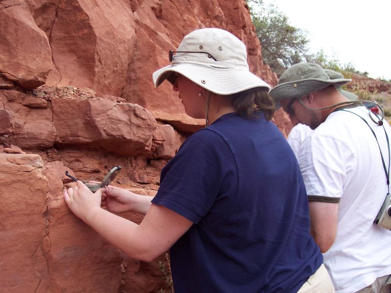
Central Arizona offers many opportunities to study and apply a wide variety of concepts in the geosciences. The highlight of this 8-day field study is our visit to the Grand Canyon where we witness geologic time first-hand. Other study sites for the week include Sedona, Oak Creek Canyon, Sunset Crater, Meteor Crater, Tonto Natural Bridge, a lava tube, Lowell Observatory, Montezuma's Castle and Montezuma's Well. There are many opportunities to collect rocks, minerals, and petrified wood. Our field work includes doing water quality analysis, practice in taking strike and dip, mapping exercises, soil and sand collection and analysis, taking core samples from trees, studying lava flows and correlating stratigraphic sections. There are also daily meteorological map discussions, and discussions on climatic influences. The evenings provide many opportunities for discussions and observations of the planets, constellations, and moon phases.

Click to see pictures


The Bahamas

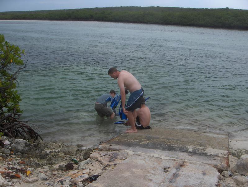
The Bahamas field method course takes place in San Salvador Island. The field station there allows for cave exploration, scuba diving, and research on the local environment. This course has a balanced mixture of geology, climate, hydrogeology/karst, and coastal processes. The island of San Salvador affords an excellent natural laboratory to explore the linkages between lithosphere, atmosphere, hydrosphere, biosphere,and the cryosphere.

Click to see pictures


Great Plains Storm Chase

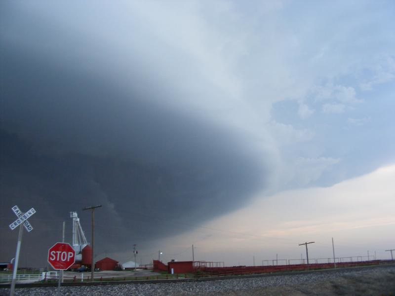
The Storm Chase Field Methods course provides a first-hand opportunity for students to encounter the power of the atmosphere in the natural laboratory known as the Great Plains. This course will provide information and familiarity with various weather analysis and storm interception techniques. In addition to visualizing the dynamics of the atmosphere, students will be given an opportunity to experience the sites and culture of the Great Plains region.

Click to see pictures


Lake Superior

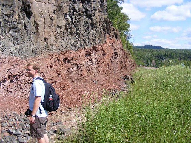
The Lake Superior field course features one of the prettiest shorelines in North America. The largest freshwater lake in the world, bounded by the northern woods, spans across the horizon and features natural arches, scenic lakeshore cliffs, enjoyable hiking trails, seagulls, and the ever-elusive moose. The Minnesota State Parks and their respective hiking trails, including Tettegouche, Gooseberry Falls, and Grand Portage, are perhaps America's best kept secret, easily rivaling the overly-crowded and touristy western National Parks in beauty and geologic wonder. Geologically, the region is unique as some of the oldest rocks in North America are exposed right at the surface. The greenstone belts (3 billion years old!!) and banded iron formations (1.8 billion years!), for example make this one of a few places in the world where one can study Achaean- and Proterozoic-aged rocks in situ.

Climatologically, the region is ideal (in the summer) with day-time highs in the low-80's and nighttime lows in the upper 40's. Meteorologically, the area is dynamic as the Lake has very interesting and exciting influence on regional weather patterns. You will see evidence of the destructive power of derechos, hints of the deep Lake Effect snows that visit the area in the winter, and experience the lake breeze in all its glory. In addition to experiencing the food and culture of the area, this field methods course has several educational activities, including collecting Paleozoic fossils, mapping Precambrian rocks, hunting for agates on the lakeshore, mineral collecting in search of copper and silver, exclusive behind the scenes tours of the National Weather Service, the world-famous Seaman Mineral Museum, and stargazing in the cool northern woods. The Lake Superior trip is an excellent course that will solidify the understanding of Earth and atmospheric sciences.

Click to see pictures


Sierra Nevada Mountain Range

This course offers both spectacular scenery and numerous opportunities to learn and apply a variety of geoscience principles. Our course begins in Ontario, CA, and then heads north, passing over the Pacific Plate to the North American Plate with opportunities to observe tectonic features created by the San Andreas Fault. We will continue north across the Mojave Desert to the Owens Valley and finally the southern Sierra Nevada. Along the way we will pass through turn of the century mining towns, visit Fossil Falls, Owens Lake, and one of the world's largest solar generating plants. We will visit the Alabama Hills, site of many western movies, collect Cambrian fossils in the White Mountains and visit Whitney Portal, trailhead to Mt. Whitney. We will also see the oldest living trees in the world, the Bristlecone Pine, the westernmost portion of the Basin and Range, ancient volcanic tuff, roof pendants, glaciers and glacial deposits, hot spring and fumaroles.

Click to see pictures


Upstate New York

The Upstate New York field course will take advantage of outstanding geologic exposures, convenient logistics, and superb documentation to bring students into contact with a suite of geology that will provide an enjoyable event to their TIG experience. Upstate New York has rocks ranging in age from over a billion years up to the recent. We will examine pillow basalts, stromatolites, thrust faults, marbles, dikes, glacial scour, caves & karst, fossils, glacial sediments, deltaic sequences, extensional tectonics, metamorphic suites, moon-like anorthosites, limestones, turbidites, mineral springs, rivers, unconformities, and much more. July in New York usually provides delightful weather, and the landscapes are scenic. We will headquarter out of a hotel in the Albany area that will provide pedestrian access to shops and restaurants, and like spokes of a wheel, visit our many geological sites as a series of one-day excursions.

Click to see pictures


Western Washington State

The spectacular scenery of Western Washington State offers many opportunities to study and apply a wide variety of concepts from the Environmental in Geosciences (ENGS) program. The course begins with three days in the area around Mt. Rainier, and Mt. St. Helens, with stops at Johnston Ridge, Coldwater Ridge, Windy Ridge devastation area, Ape Cave, Hummocks Trail, Paradise, and the Nisqually Glacier. The course continues the Olympic Peninsula with stops at Kalaloch, Ruby, and Rialto Beaches (including a study of tide pools), the Hoh Rain Forest, and Hurricane Ridge in Olympic National Park where we will have a Star Party. The course will conclude with a study of metamorphism and glacial valleys in North Cascades National Park, volcanic arcs and accreted terrains in Snoqualmie Pass, and the Missoula Flood in the Channeled Scablands. There are also daily meteorological map discussions, and the many opportunities to discuss the climate of the Pacific Northwest and the influences of the mountain ranges on precipitation distribution and vegetation.

Click to see pictures


Yellowstone National Park

There are few places in the country that can compete with beauty and diversity that you will find in Yellowstone and the Grand Tetons. This field study course begins in the Twin Falls, ID where we take a day to explore Hagerman Fossil Beds National Monument, Thousand Springs, and the Snake River Canyon. We visit a fossil preparation lab and the site of their most recent dig, and discuss the evidence for the Bonneville Flood. We then head to Craters of the Moon National Monument where we hike the basalt lava flows from the Great Rift, and explore lava tunnels and ice caves. In Yellowstone, we stay at Old Faithful for three nights, and spend our days studying the geysers and hot springs, and we visit the Hebgen Lake earthquake site. We then head south for two days in the Grand Tetons studying Basin and Range geology, glacial features, and hiking Cascade Canyon. We then return to Twin Falls along the Snake River Valley trail of the Yellowstone Hot Spot. Each day includes a meteorological map discussion and discussions on local climate controls. There are also opportunities to observe and discuss the night sky and local environmental issues.

Click to see pictures

Comprehensive Exam

The comprehensive exam is a proctored, essay style exam that covers material learned in the required courses, and a subset of the electives. You must pass the comprehensive exam in order to receive your degree.

Students that begin the program in the fall semester will most likely take the comprehensive exam early in the final summer semester. MSU requires that students be within 6 credit hours of graduating or in the final semester in order to take written comps. (You must also have a 3.0 GPA).

Students who do not begin the program in fall may need to take the exam in a different semester. The Department of Geosciences must have at least 2 weeks’ notice before you can schedule your exam. In most cases, we will provide you information in the spring about when the exam can be scheduled. Students taking the exam in other semesters should be aware of the 2-week notice requirement and plan accordingly.


Contact Information

Photo of Joy Bailey

Joy Bailey

Online Education

  • Coordinator
Photo of Dr. Michael Brown

Dr. Michael Brown

Geosciences

  • Graduate Coordinator
Yasma Jacobs Headshot

Yasma Jacobs

Geosciences

  • Academic Advisor
Headshot of Christa Haney

Dr. Christa Haney

Department of Geosciences

  • Director of Geosciences Distance Learning Programs